
File:Indonesia Bali location map.svg

Size of this PNG preview of this SVG file: 600 × 600 pixels. Other resolutions: 240 × 240 pixels | 480 × 480 pixels | 768 × 768 pixels | 1,024 × 1,024 pixels | 2,048 × 2,048 pixels | 1,250 × 1,250 pixels.
Original file (SVG file, nominally 1,250 × 1,250 pixels, file size: 1.83 MB)
Captions
Captions
Add a one-line explanation of what this file represents
Summary
[edit]
| Description |
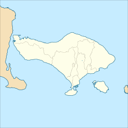
English: Location map of Bali, Indonesia
Geographic Coordinate System WGS 1984 (EPSG: 4326) Equirectangular Projection Geographic limits of the map:
|
| Date | |
| Source | Own work |
| Author | Mandamaruta |
Licensing
[edit]
I, the copyright holder of this work, hereby publish it under the following license:
This file is licensed under the Creative Commons Attribution-Share Alike 4.0 International license.
- You are free:
- to share – to copy, distribute and transmit the work
- to remix – to adapt the work
- Under the following conditions:
- attribution – You must give appropriate credit, provide a link to the license, and indicate if changes were made. You may do so in any reasonable manner, but not in any way that suggests the licensor endorses you or your use.
- share alike – If you remix, transform, or build upon the material, you must distribute your contributions under the same or compatible license as the original.
File history
Click on a date/time to view the file as it appeared at that time.
| Date/Time | Thumbnail | Dimensions | User | Comment | |
|---|---|---|---|---|---|
| current | 07:59, 21 December 2017 | | 1,250 × 1,250 (1.83 MB) | Mandamaruta (talk | contribs) | User created page with UploadWizard |
You cannot overwrite this file.
File usage on Commons
The following 17 pages use this file:
- Bali
- Category:Bali
- Category:Bali in the 21st century
- Category:Births in Bali
- Category:Bridges in Bali
- Category:Deaths in Bali
- Category:Flora of Bali
- Category:Geography of Bali
- Category:Maps of Bali
- Category:Mountains of Bali
- Category:People of Bali
- Category:Petrol stations in Bali
- Category:Religious buildings in Bali
- Category:Rivers of Bali
- Category:Shopping malls in Bali
- Category:Sports in Bali
- Category:Villages in Bali
File usage on other wikis
The following other wikis use this file:
- Usage on bh.wikipedia.org
- Usage on de.wikivoyage.org
- Usage on dtp.wikipedia.org
- Selat Badung
- Muzium Bali
- Modul:Location map/data/Indonesia Bali
- Modul:Location map/data/Indonesia Bali/doc
- Denpasar
- Uluwatu, Bali
- Selat Bali
- Katedral Spiritu Tobitua, Denpasar
- Kotogisan Lovina
- Bawang Ayung
- Mangupura
- Seminyak
- Cengiling
- Pura Dalem Agung Padangtegal
- Kotogisan Pandawa
- Budakeling
- Singaraja
- Kuil Besakih
- Padangtegal
- Nulu Batur
- Pura Lempuyang Luhur
- Penestanan
- Kubutambahan, Buleleng
View more global usage of this file.